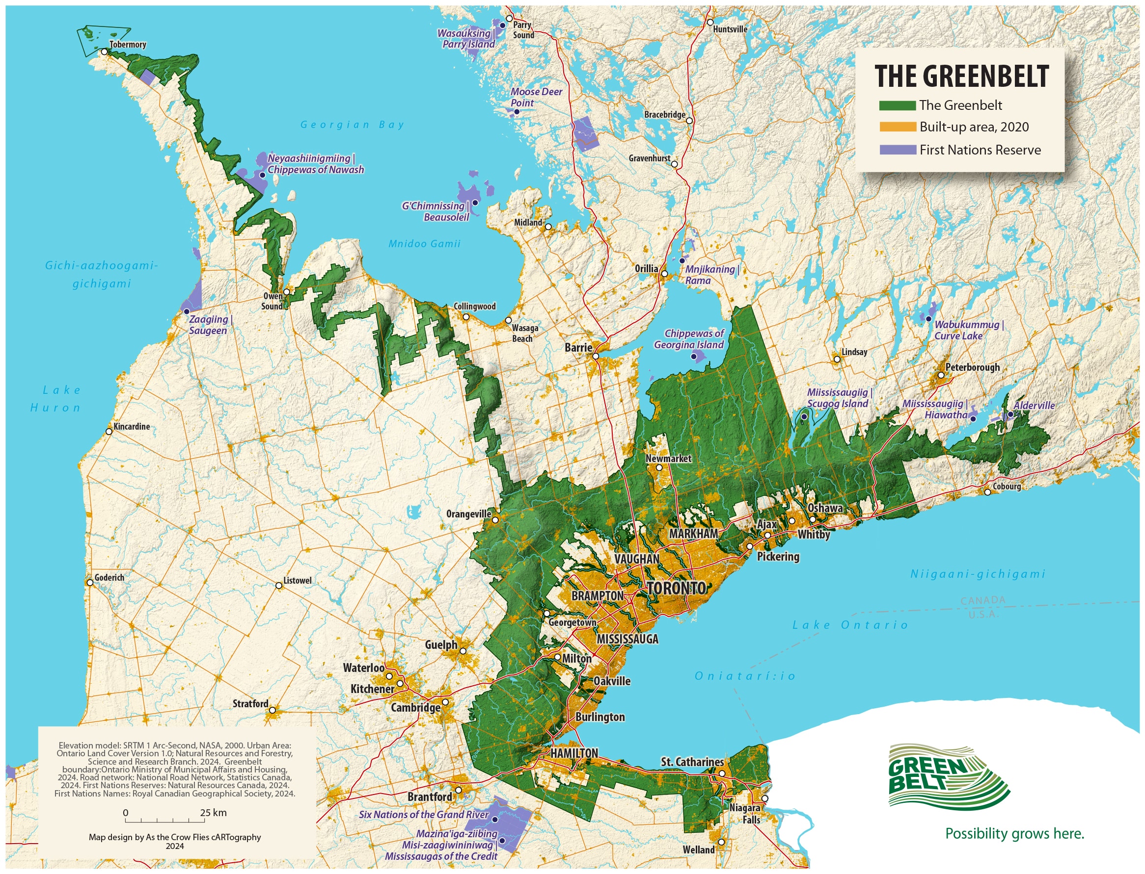
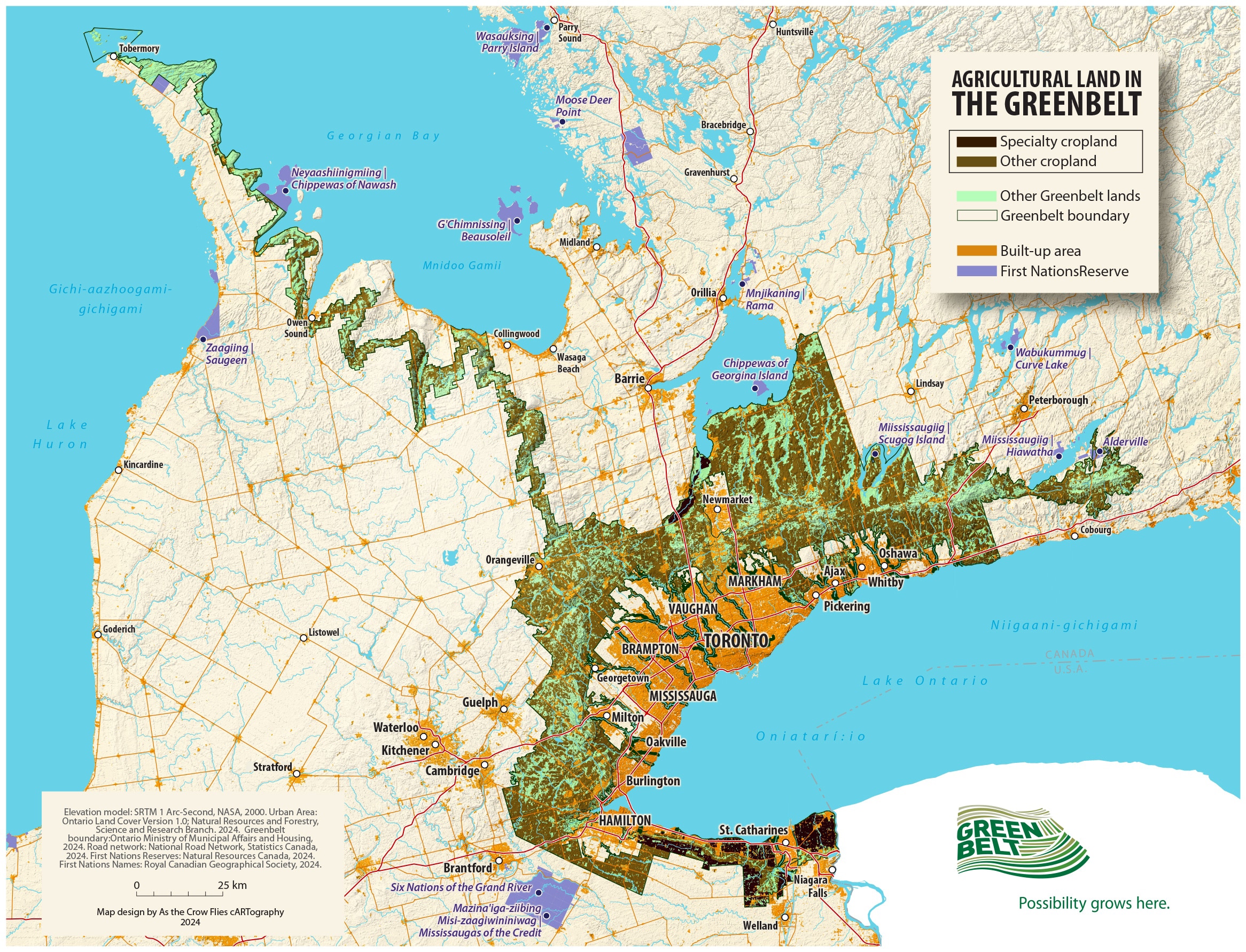
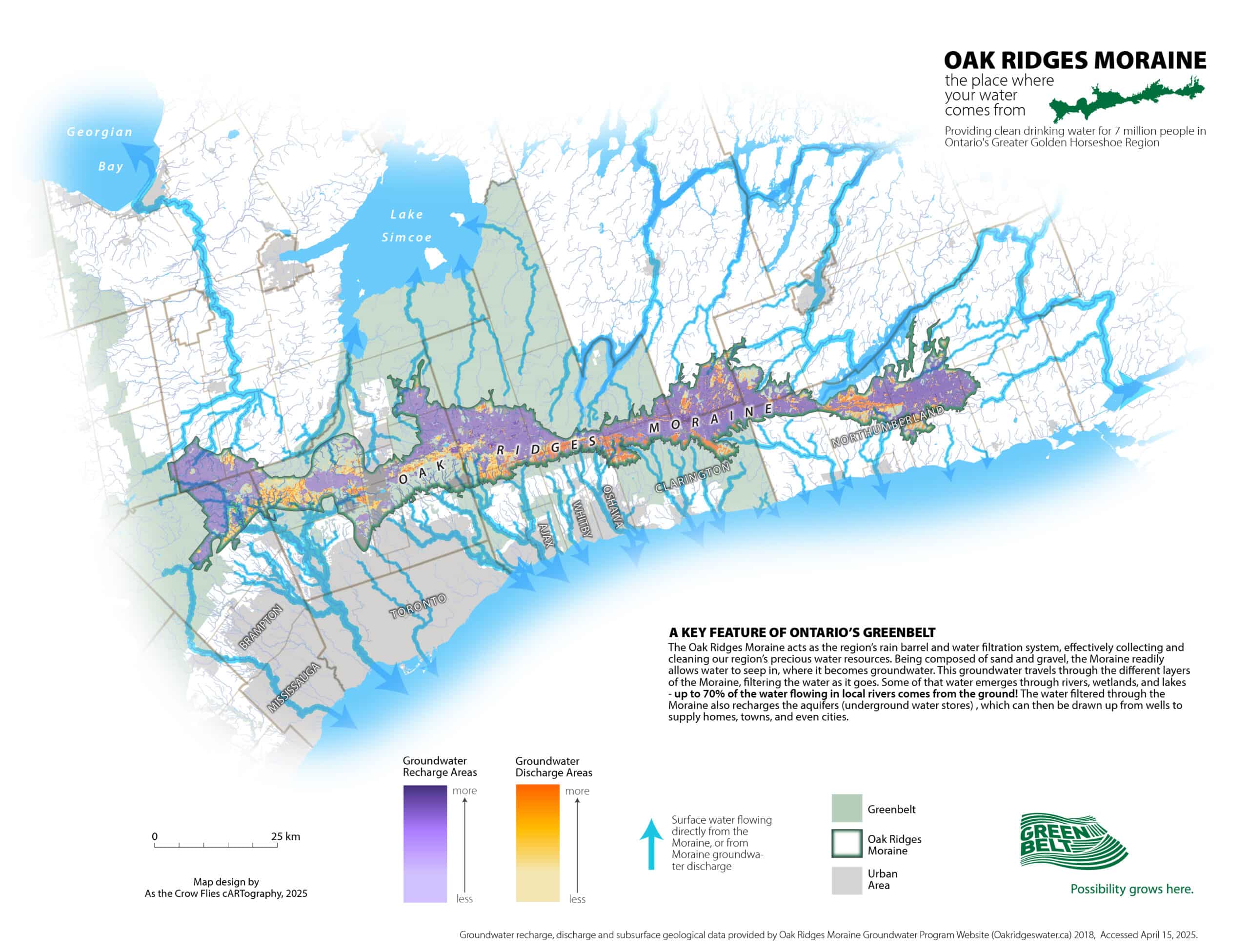
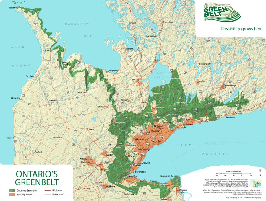
Greenbelt Maps

Greenbelt Area

Protected Countryside
Niagara Escarpment
Oak Ridges Moraine
Urban River Valley
Specialty Crop Areas

Download Maps of the Greenbelt

The following maps are provided for informational purposes only for detailed information on the Greenbelt’s boundaries, please consult your municipality.

Current Maps

Greenbelt [2024]

Download Map

Greenbelt Agriculture [2024]

Download Map

Oak Ridges Moraine [2025]

Download Map

Greenbelt Plan [2017]

Download Map

Settlements within the Greenbelt [2017]

Download Map

Holland Marsh [2017]

Download Map

Niagara Peninsula Tender Fruit and Grape Area [2017]

Download Map

Greenbelt Plan Detailed Overview [2017]

Download Map

Natural Heritage System [2017]

Download Map

Natural System Connections [2017]

Download Map

Key Plan Protected Countryside [2017]

Download Map

Historic Maps

2005 Greenbelt Map

Greenbelt [2005]

Download Map

Greenbelt Agriculture [2005]

Download Map
Hiker overlooking the land

Explore Our Curated Routes and Itineraries

From hiking to cycling, breweries to parks, we’ve picked out the best the Greenbelt has to offer.